Coastal Design Engineering and Development
We offer integrated solutions for coastal area design, planning, and development with expert assistance.
Geo-survey services for coastal design engineering and development are a valuable tool for collecting and analyzing critical geospatial data. This data is then utilized to inform the planning and development of projects related to coastal and regional areas. Our services are designed to enable clients to optimize their existing resources while also identifying new opportunities for growth. Recognizing that each project is distinct, our team collaborates closely with clients to determine the optimal approach to meet their specific requirements.
Coastal Development
Our expertise lies in coastal development, which pertains to the human-made alterations to the natural environment in coastal areas. We offer services to construct structures such as those used for protection, commerce, communication, and recreation.
Methods
 |
Single Beam Echo Sounder |
 |
Multi Beam Echo Sounder |
 |
Side Scan Sonar |
 |
Sub Bottom Profiler |
 |
Terrestrial Topographic |
 |
Aerial Topographic |
 |
Aerial Photogrammetry |
 |
Geotechnical Investigation |
Metocean Study for Coastal Development
We employ measurement and hydrodynamic modeling techniques to precisely characterize coastal environmental conditions. Our effective solutions are specifically tailored to tackle the challenges associated with coastal erosion and the development of coastal structures.
Methods
 |
ADCP (Acoustic Doppler Current Profiler) |
 |
AWAC (Acoustic Waves and Current) |
 |
Weather Station |
 |
Tide Gauge |
 |
CTD (Conductivity, Temperature, Depth) |
Land Reclamation
We conduct feasibility studies and nearshore geo-surveys as part of our comprehensive approach to support reclamation projects.
Methods
 |
Single Beam Echo Sounder |
 |
Multi Beam Echo Sounder |
 |
Side Scan Sonar |
 |
Sub Bottom Profiler |
 |
Geotechnical Investigation |
Water Resource Study, Irrigation, and Agriculture
We offer professional services to support sustainable daily living and area development, which include geo-survey and mapping services to cater to the specific requirements of agriculture, irrigation, and drinking water needs.
Methods
 |
Terrestrial Topographic |
 |
Aerial Topographic |
 |
Aerial Photogrammetry |
 |
Soil Investigation |
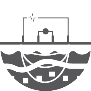 |
Soil Resistivity Survey |
